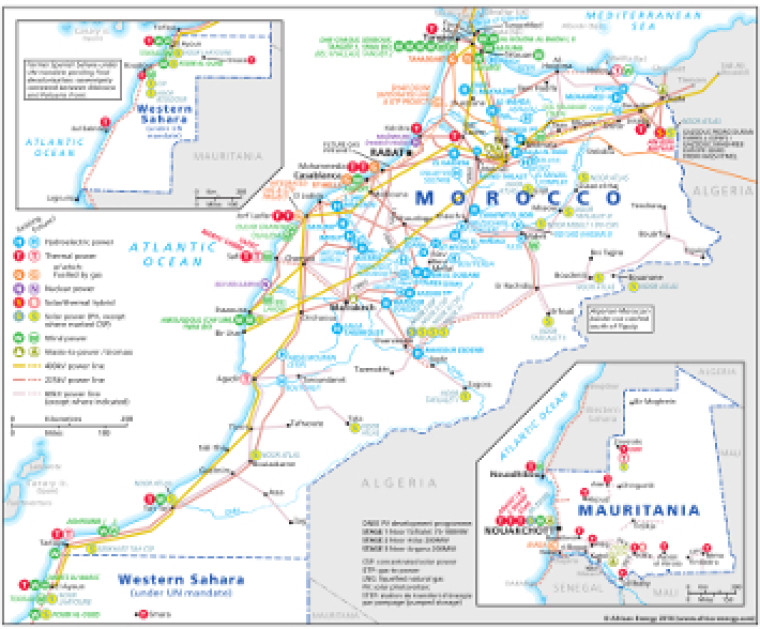
Revised in August 2016, this map provides an overview of power sector infrastructure in Morocco and Mauritania.
The locations of actual and planned power generation facilities are shown by type – including hydroelectric, thermal, gas, solar (PV and CSP), wind, nuclear and waste-to-power – alongside existing and future power lines, ranging from 60kV to 400kV.
Actual and planned cross-border interconnectors to Algeria and Europe are shown.
Separate inset maps show generation and transmission infrastructure in the Western Sahara region and Mauritania
The map is a PDF file, made using eps graphics, meaning that there is no loss of resolution as the file is enlarged.
Price: £70 or available as part of a full subscription.
Single African Energy map
£895
(1 standard map)
Subscribe to African Energy
African Energy is a brand of


