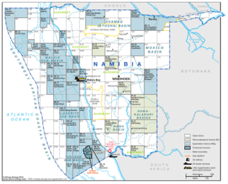
Revised in September 2018, this map provides an overview of oil and gas exploration in Namibia.
Open and licensed acreage (reconnaissance, exploration and production) is shown, with block operators marked, alongside associated downstream infrastructure such as pipelines, tanker terminals, refineries, gas processing plants and proposed LNG regasification facilities.
The map is available as a PDF file using eps graphics, meaning that there is no loss of resolution as the file is enlarged.
Single African Energy map
£895
(1 standard map)
Subscribe to African Energy
African Energy is a brand of


