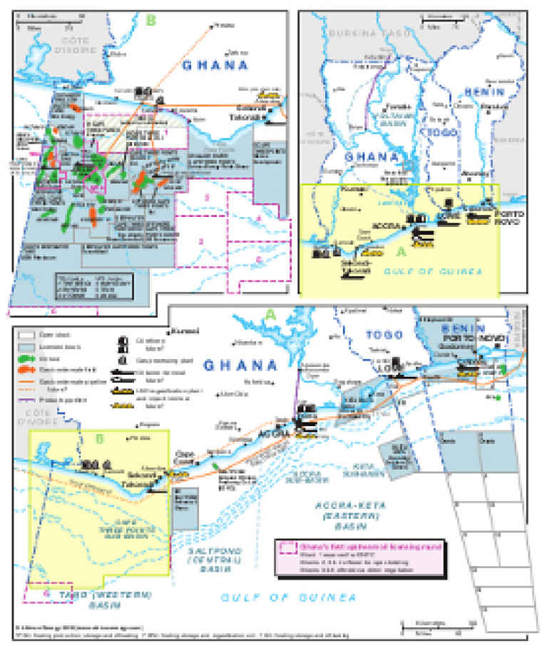
Revised in October 2018, this map provides a detailed overview of the hydrocarbons sector in Ghana, Benin and Togo. Open and licensed acreage is shown, with block operators marked, alongside associated downstream infrastructure such as pipelines, tanker terminals, refineries, gas processing plants and proposed LNG regasification facilities (including FSRUs). An inset map provides greater detail of the offshore Cape Three Points Sub-Basin, including the location of oil and gas fields. The map is available as a PDF file using eps graphics, meaning that there is no loss of resolution as the file is enlarged.
Single African Energy map
£895
(1 standard map)
Subscribe to African Energy
African Energy is a brand of


