Equatorial Guinea Bid Round 2016


Map
Issue 325
10 June 2016

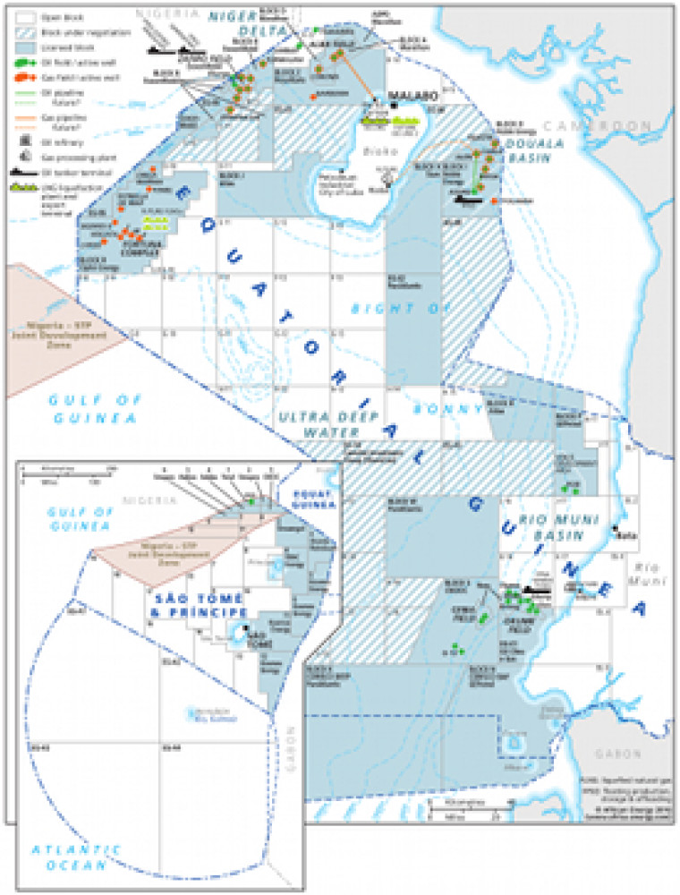
Published as part of African Energy 325, this map provides an overview of exploration and production activities in Equatorial Guinea. Open and licensed blocks are clearly marked on the map, along with associated infrastructure such as the locations of oil pipelines, refineries and tanker terminals. The map is made using eps graphics, meaning that there is no loss of resolution as the image is enhanced.

Single African Energy map

£895

(1 standard map)

Subscribe to African Energy

View subscription options

Don't have an account?

Register for access to our free content

An account also allows you to view selected free articles, set up news alerts, search our African Energy Live Data power projects database and view project locations on our interactive map

Register

Interested in more than one map?

The African Energy Atlas is the essential reference book for all energy professionals working in Africa, with maps, graphics and articles covering all aspects of the energy sector.

Take a closer look