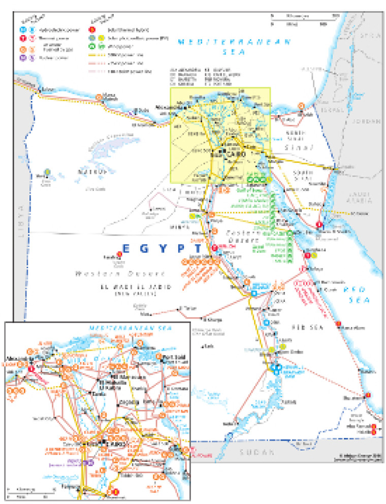
Revised for the African Energy Atlas 2016/2017, this map provides an overview of electricity infrastructure in Egypt.
The locations of actual and planned power generation facilities – including solar (PV and solar/thermal hybrid), wind, hydro, nuclear, gas and thermal plants – are marked alongside existing and future transmission lines, ranging from 110kV to 500kV
An inset map provides greater detail of the concentration of infrastructure in the Cairo and Nile Delta region.
The names of lead project developers and investors are noted alongside the various wind projects planned for Gulf of Suez and Gulf of Zeit.
The map is a PDF file, made using eps graphics, meaning that there is no loss of resolution as the file is enlarged.
Single African Energy map
£895
(1 standard map)
Subscribe to African Energy
African Energy is a brand of


