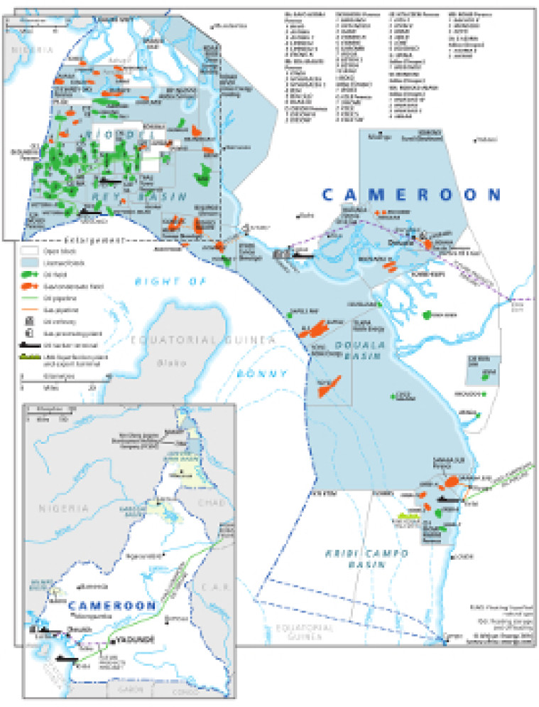
This map – originally published within the African Energy Atlas 2016/2017 – provides an overview of Cameroon’s oil and gas sector infrastructure.
Open and licensed acreage is shown, with block operators marked, alongside the location of oil and gas fields.Associated downstream infrastructure is included such as oil and ga s pipelines, refineries, gas processing plants, tanker terminals and the location of a planned FLNG facility.
An inset map shows the route of the Chad-Cameroon oil pipeline.
The map is a PDF file, made using eps graphics, meaning that there is no loss of resolution as the file is enlarged.
Single African Energy map
£895
(1 standard map)
Subscribe to African Energy
African Energy is a brand of


