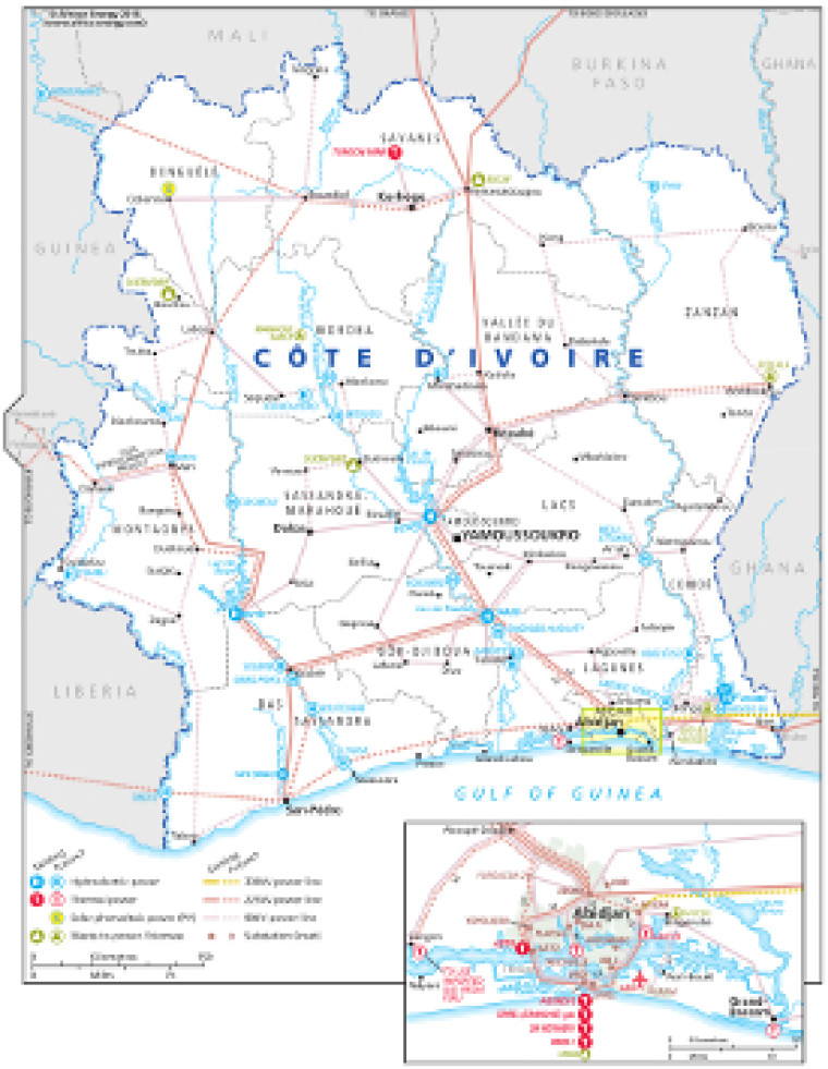
This map – originally published within the African Energy Atlas 2016/2017 – provides an overview of electricity infrastructure in Côte d’Ivoire.
The locations of actual and planned power generation facilities are shown by type – including hydroelectric, thermal, solar PV, and waste-to-power – alongside existing and future transmission lines, ranging from under 90kV to 330kV.
Actual and planned cross-border interconnectors are shown including links to Liberia, Ghana, Burkina Faso, Mali and Guinea.
An inset map provides more detail of the area surrounding Abidjan.
The map is a PDF file, made using eps graphics, meaning that there is no loss of resolution as the file is enlarged.
Single African Energy map
£895
(1 standard map)
Subscribe to African Energy
African Energy is a brand of


